


There are a number of well-known walking trail guides available here in the Tourist Office, but there are also a number of other beautiful trails that remain lesser known, yet equally worth the walk. Three of these are on quiet country roads (as always, take care and be aware of traffic, and leave no trace), and one wooded trail.
Ringarogy Island Loop Walk (1-1.5 hrs, depending on pace)


Start Point: Skibbereen
Take the R595 for Baltimore, passing Inish Beg Island and Kileena holiday homes (both on the right). After left-hand bend, the old railway cottage should be visible on your left-hand side. The road widens and about 500m on the left is the causeway to Ringarogy. You can park on the side of the road on the hard shoulder (at your own risk). This is a beautiful and fairly easy walk with only a few slight inclines. Ringarogy Island can be accessed by walking over the causeway. Stay left at the end of the causeway, walk for about ten minutes, and go left again (recommend doing this walk clockwise).


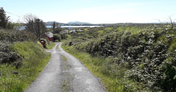
Toe Head Loop Walk (leisurely 1 hr walk)


Start Point: Skibbereen
Situated between Tragumna and Castletownshend on the R596 from Skibbereen, this is a beautiful walk right out on the headland of Toe Head. This is an easy walk , has a sharp incline at the start but after that it’s easy enough. Parking is available at Toe Head Beach. From the beach, keep right and then take a left at the Y for that sharp incline.Do the walk in a clockwise direction.


Rineen Forest Walk (over an hour)

Start Point: Skibbereen
Take the R596 (Castletownshend Road) for about 6km to Castlehaven Old Creamery, and take the left for Union Hall. After 2km you will come to a Y junction- keep to your right, and Rineen Forest Walk is approx 3km on your right-hand side. There should be a sign visible. You can park in the small car park- barrier is usually down. At the barrier, take the trail immediately down to your right. This narrow path will continue for approx 15 mins before emerging onto the main trail through the forest. After about 20m take the path down to your right, which will take you along a path on water’s edge. At one point near a stream the path appears to end, but actually continues left for a short distance then continues as before. This is a looped walk, with lovely views of Raheen Castle and the ruins of an old lime kiln. This is a fairly easy walk, but there are a few slight inclines, and as always, please take care underfoot (walking boots advised). This can be either an out-and-back walk or a loop walk (to avoid the loop, take the path that climbs up to the left to get to the main forest trail and back to the car park).

Coastal Walk (over an hour)


Start Point: Skibbereen
On this walk there are a number of very sharp corners, so please take careTake the R596 for about 4km, taking a right at the lake for Tragumna. Follow that road for about 1.5km until Tower Lodge is in view, then take a left until Tragumna Beach and park in the car park there.. Leaving the car park, keeping the beach on your right, pass the Skibbereen Eagle Pub. You will start climbing (at this point, there are 3 very sharp corners, so please take care and swap to the other side of the road at these points) and after approx half a km you will reach the top of the incline. Take the road to your left, and after about 500m you will come to a Y. Take the road to your right. Continue your walk, and you will start climbing down and will find yourself back on the main coast road, looking across at Toe Head. Turn right and continue your walk along the coast road until you arrive back on Tragumna.


By Emma O'Donoghue